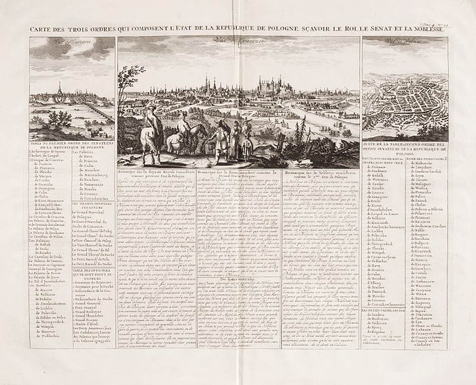
Pochodzi z "Atlas historique, ou nouvelle introduction a l`histoire, a la chronologie, et a la géographie ancienne et moderne" (t. IV, tabl. 24), opracowanego przez N. Gueudeville`a; tomy wydawano w Amsterdamie (dwie edycje) w l. 1705-1739, zaś sam t. IV w l. 1714 oraz 1735.
[Carte des trois ordres qui composent l`Etat de la Republique de Pologne scavoir le roi et le senat et la noblese], 1714
Miedzioryt ręcznie kolorowany;
wym. planszy: 425 x 530 mm, płyty: 348 x 455 mm;
pod tytułem widok Krakowa wg P. Schuta, po bokach małe widoki Warszawy i Wilna. Poniżej tekst (uwagi o godności królewskiej, senacie i senatorach mniejszych).
Pochodzi z "Atlas historique, ou nouvelle introduction a l`histoire, a la chronologie, et a la géographie ancienne et moderne" (t. IV, tabl. 24), opracowanego przez N. Gueudeville`a; tomy wydawano w Amsterdamie (dwie edycje) w l. 1705-1739, zaś sam t. IV w l. 1714 oraz 1735.